This post is shared with you by Kaity Haley, 6th grade Social Studies teacher at Grover Middle School
I discovered Google My Maps on my weekly Pinterest binge, and fell in love with it. As a Social Studies teacher, I was so excited to see how my students could use it in the classroom. Our 6th grade class was entering our unit on Ancient Egypt when I introduced the tool to my classroom. I started out with a quick tutorial video. It was created by a high school teacher to guide his students through a particular project, but demonstrated the awesome tools that My Maps offers, in a student friendly manner. Before beginning our My Map assignment all students viewed the video for homework.
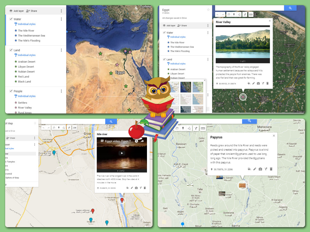
Students began the My Map assignment by conducting research on Egyptian geography. They also explored culture and life in Egypt. After conducting research through guided materials and leveled readings, the students had a variety of information. They then identified common categories and trends with this information. Students were then presented with the following question: How did geography and climate impact life in Egypt? However, instead of using their research to construct a paragraph response, they utilized their learning to answer the question in a My Map. Their task was to answer the question using the visual map instead of the traditional paragraph.
Students spent 2 days in class, then, creating their maps. They were encouraged to translate their categories from the research in to different layers on their My Map (reflecting on the organizational skills we study in writing). There were also invited to use the images and videos from their research to add more visual elements to their maps. In general their goal was to answer our research question in this new medium...and my students did an excellent job.
I was so happy with the results of the My Maps, but was more excited by the discussion it allowed us to have as they worked in class. After clicking on the satellite view, students were able to see how drastically the Nile affects vegetation and thus life in Egypt. They used the measurement tools, without my prompting, to consider the distances between various ancient cities and the transportation that was necessary. And most importantly, they wanted (and at times competed) to create more connections, pins, and layers to strengthen their argument. It was fantastic to see.
I have attached a few screen shots of our final products. Google My Maps invites so many diverse uses. I can’t wait to use it from the start of September next year, where my goal is to have the students create an interactive map of all the units we study in one My Map. The possibilities with such a tool seem endless.
Ready to start exploring Google Maps? Check out this great resource: https://goo.gl/dVu1vi and reach out to the Teacher Resource Specialist for Technology in your building for support.
No comments:
Post a Comment